Topography and Vegetation

to vegeTopograhy and Vegetation

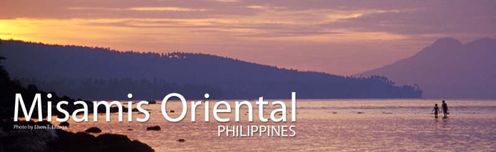
Generally rugged, with 70 percent mountains and hills. The rest are coastal plains and valleys traversed by brooks and rivers that provide adequate underground water.

On the eastern portion of the province are two inactive volcanoes — Mt. Balatucan, which at 2,560 meters, is the highest peak; and Mt. Lumot.

source:wikipedia

Soil Type

GENSCH Arborloo in a rural area of Misamis Oriental (Mindanao, Philippines)

soil typeThe town has a generally rugged topography, characterized by gently rolling hills and mountains with cliffs and escarpments. The soil is classified as Jasaan clay, with a deep soil profile (greater than 1 m) and rapid drainage. It is generally acidic (pH 3.9 to 5.2), with low cation exchange capacity (CEC), low to moderate organic matter content (1.8%), high aluminium saturation, and low levels of available phosphorus and exchangeablepotassium.


Land Area

land areaLand Area

Claveria is the largest among the 24 towns of Misamis Oriental comprising one-third of the total land area of the province. The current total land area of the municipality measures 825 km2 as per 2006 data reduced from its original of 894.90 km2 base from 1990 records. Territorial land dispute has been claimed by several neighboring areas such as the city of Gingoog, towns of BalingasagVillanuevaJasaan, and Malitbog of Bukidnon.

source: wikipedia

Geography

Image

geographyGeography

Located in Northern Mindanao, it is bordered by the provinces
of Bukidnon to the south, Agusan del Norte to
the east and Lanao del Norte to the west.
On the north lies Camiguin Island in the Bohol Sea.

Misamis Oriental is one of the five provinces of Northern Mindanao. Falling between 8°28’38″516
Latitude and 142°38’35″235 Longitude, the province is located along the northern coast of the island
of Mindanao. It is bounded on the north by Macajalar Bay, on the west by Iligan Bay, on the south
and southwest by the provinces of Bukidnon and Lanao del Norte, and on the east by Agusan del Norte.

source:wikipedia

Climate

misz or climateClaveria has a rainfall distribution of five or six wet months (>200 mm/month) and two or three dry months (<100 mm/month). Rainfall patterns throughout the municipality vary with elevation, with the upper areas having a relatively greater amount of rainfall than the lower areas. The rainfall pattern strongly influences cropping patterns and land use across Claveria’s landscape. Naturally the town is the only municipality of the province which has a cooler temperature ranging below 22 degrees Celsius in as much as 16 degrees Celsius and lower in the higher areas.

source:wikipedia